Mt Cook
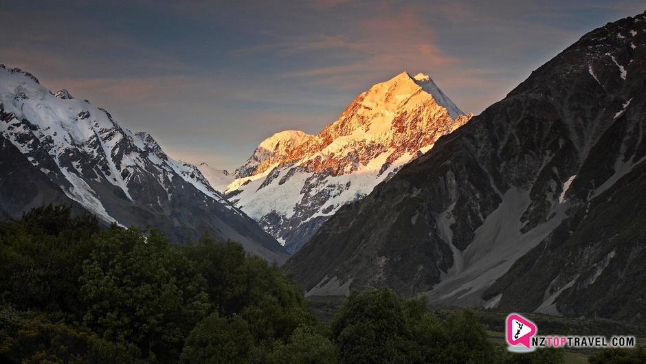
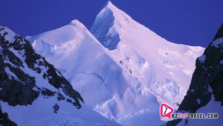
Mount Cook, the highest mountain in New Zealand, lies in the area of mid-western Southern Alps in South Island. There are 22 mountains near Mount Cook that are covered with snow throughout the year and that are over 3,000 meters (10,000 feet) high. Mount Cook is 3,754 meters (12,316 feet) high and on its both sides respectively lie Hooker Glacier (west side) and Tasman Glacier (east side).
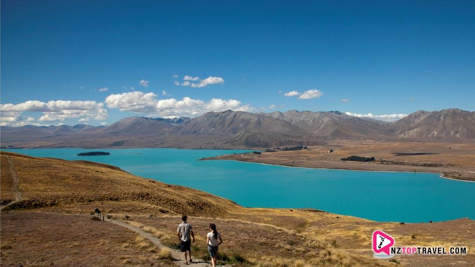
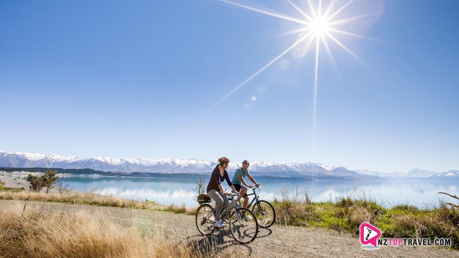
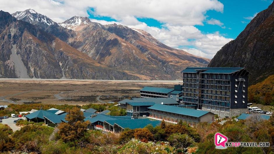
Mount Cook National Park is erected next to West National Park. At the V-shaped valley of Mount Cook that was created by the corrosion of glaciers, there are two tranquil and beautiful lakes---Lake Pukaki and Lake Tekapo. The melting water of the Southern Alps flows across several lakes and then Waitaki River at South Kanterbury Plain and finally flows eastward to South Pacific.
The Southern Alps longitudinally crosses the central area of South Island. Many mountains in Southern Alps are covered with snow and stretch for several hundred kilometers. In earlier years voyagers, when they sailed next to the east coast of South Island, found some snow-topped peaks that roared into the sky and named the place as "Land of the Long White Cloud”.
There are 22 mountains in total that are over 3,000 meters (10,000 feet) high. Mount Cook, the highest mountain, is 3,754 meters (12,316 feet) high. Mount Cook National Park covers an area of 70,011 acres. In the park there are snow mountains, glaciers, rivers, lakes, forests, animals and plateau vegetation, so the amazement that people will feel in the park is imaginable and incomparable.
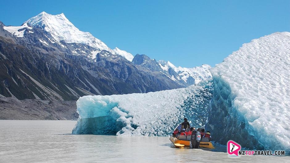
Towering like a giant, Mount Cook is capped with snow throughout the year and in the valley among mountains are many glaciers hidden, including Tasman Glacier, which is about 29 kilometers long, 2 kilometers wide and 600 meters deep and is the longest glaciers found in the world apart from those in the polar regions. The movements of glaciers, the falling of mountains with stones, and the sunshine, the surface of glaciers begins to have numerous cracks and ice pyramids in different shapes, which is very eye-catching.
Mount Cook National Park, located in the mid-western area of South Island, is in the center of Southern Alps. The park is narrow and long. It is 64 kilometers long and 20 kilometers at its narrowest point. the park covers an area of 70,000 acres. Its south side reaches Arthur’s Pass and west side touches Meyn Mountain. The park also belongs to the world natural heritage site in Te Wahipounamu and southwest regions and is of acknowledged great value of natural conservation.
1/3 part of the park is covered with snow throughout the year. There are also glaciers and snow mountains. There are 15 mountains that are over 3,000 meters high, of which the outstanding Mount Cook, known as the "roof of New Zealand”, is 3,764 meters high and is the highest mountain in New Zealand and the second highest mountain in Oceania. The western regions and plateau that is over 1,070 meters high are sterile but black stones are scattered in snows. Among the mountains are some glaciers and waterfalls. On the west side is Hooker Glacier and on the east side is Tasman Glacier which is 29 kilometers long and 3.2 kilometers wide and one of the longest glaciers in the world.
There are many lakes in Mount Cook National Park, of which the glacial lakes are deep red. The lakes are clear, reflecting images of mountains, and thus are very spectacular. There are also thick forests that are less than 1000 meters above the snow line. There are parrots, eagles, antelopes and wild cats. It is an ideal place for skiing, mountaineering and hunting.
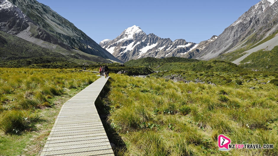
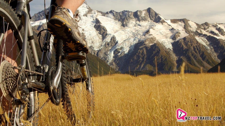
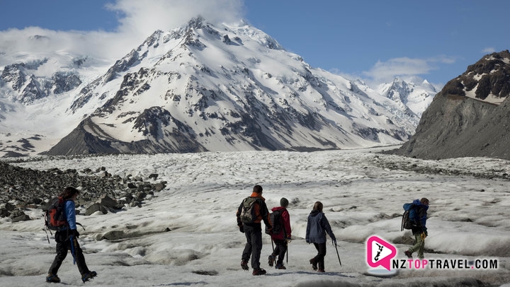
The round trip to Hooker Valley Track, nine kilometers long, takes three to four hours. It is the most famous track in Mount Cook National Park. On the road to Hooker Valley Track, travelers can enjoy the view of Mount Cook and nearby mountains. In spring and summer, the green alpine meadows and numerous charming flowers, including lilies in Mount Cook, will also embrace your arrival. Alpine Memorial is the best place to overlook the valley as well as high mountains and ice falls that are near to Mueller Glacier. Besides, it is also an attraction to cross the suspension bridge over Hooker River.
At the end of Hooker Valley Track lies Terminal Lake. Most travelers will choose to return by the way they come when they arrive at the blue Glacier lake. However, if you choose to go on, you will get to the windy track that lead to Hooker Hut. For safety concerns, you could only go on with the a team guided by tours.
Apart from Hooker Valley Track, there are many other short tracks, including Kea Point Track whose end is Kea Point. If you take the track, you can go on a three-hour round trip to Hooker Valley, Mueller Glacier and Glacier Lake. The track has a side road, which can lead to the beautiful Sealy Tarns. In addition, Wakefield Track is spread around Hooker Lake.